How to Read a METAR Like You Actually Know What You're Doing
Most student pilots learn to read METARs the same way they learn R/T calls, by memorizing the codes and hoping it’s enough.
And for a written exam, maybe it is. But here’s the truth: decoding a METAR is not the same as understanding what it’s telling you. Anyone can recite what “BKN020” means. But can you review a full METAR and determine whether that layer will interfere with your approach? Or whether the wind shift halfway down the runway is a go-around waiting to happen?
The skill isn’t in reading the message, it’s in using it.
METARs, TAFs, SPECIs, SIGMETs, TRENDs, these aren’t background noise. They’re tools. Knowing how to work with them is what separates a checkbox pilot from someone ready to make real-world calls.
So let’s break it all down, piece by piece. Not just what each part means, but how you use it when it matters.
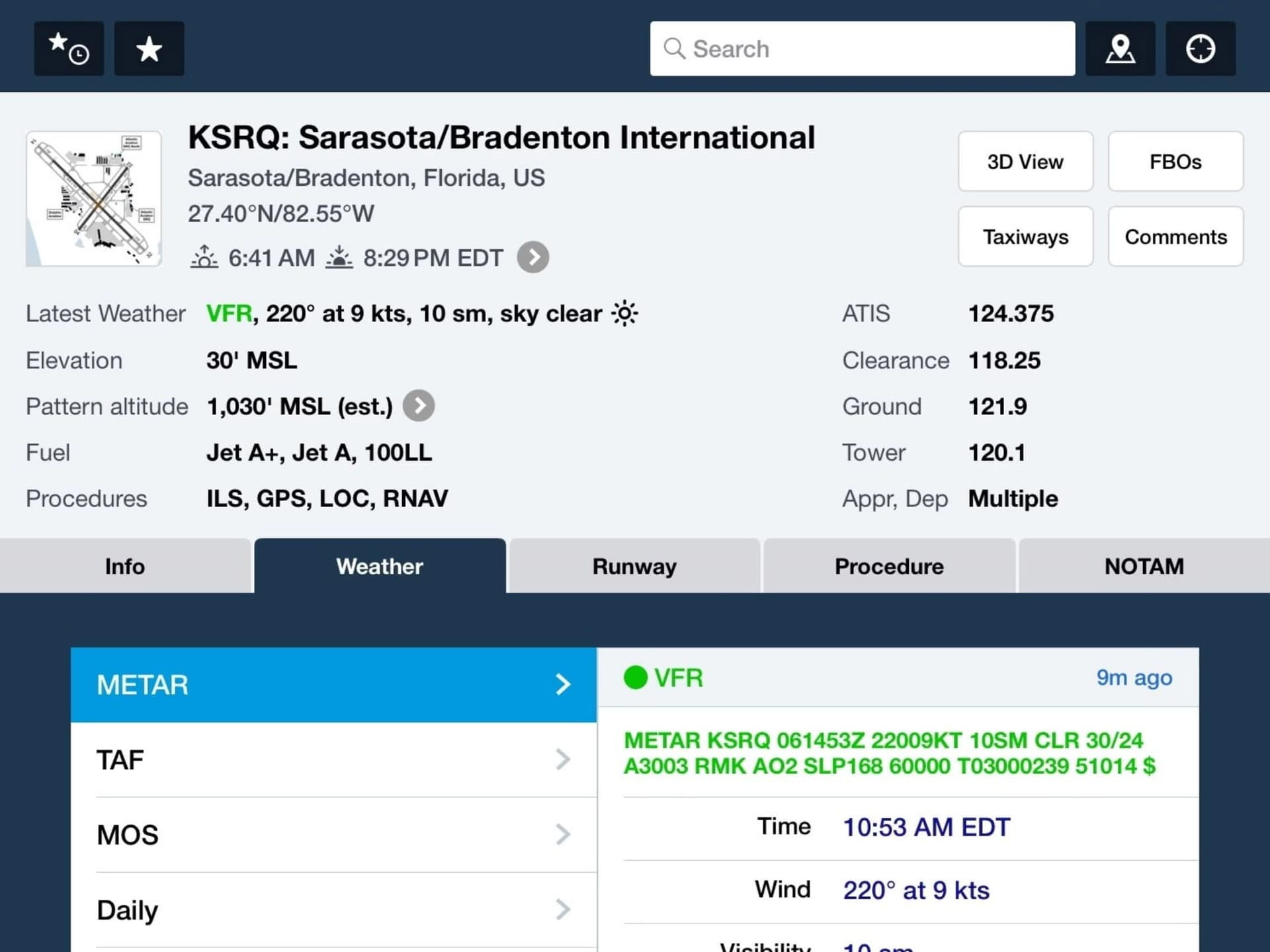
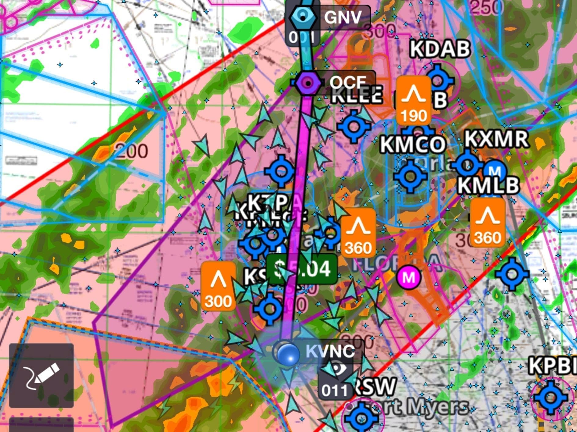
METAR for Sarasota International Airport (KSRQ)
METAR: Your Hourly Reality Check
A METAR is an hourly or half-hourly surface observation. It is code for Aerodrome Met Report and tells you what’s happening now at an aerodrome, not what might happen, not what it felt like yesterday.
Let’s dissect this example:
METAR VIDP 061230Z 31012KT 280V350 4000 HZ VCTS FEW030 SCT040 BKN100 26/24 Q1003 NOSIG
Decoded:
- METAR- Type of report: In this case, it is a METAR.
- VIDP – The four-letter ICAO Designator of the issuing aerodrome: Delhi.
- 061230Z – Date-Time: Report issued on the 6th at 1230 UTC, The first two digits signify the date while the following denote the time of issue in Zulu (Z) or UTC.
- 31012KT 280V350 – Wind Information : Wind direction 310° at 12 knots, varying between 280° and 350°.
- 4000 HZ – Visibility: 4 km in Haze. Think: VFR minimums and low sun angles.
- VCTS- Present Weather: Thunderstorms in the vicinity.
- FEW030 SCT040 BKN100 – Clouds: few at 3,000 ft, scattered at 4,000, broken at 10,000. (BKN or OVC= ceiling)
- 26/24 – Temperature 26°C, Dew Point 24°C (small difference = mist risk). Also: hot air, high Density Altitude, sluggish performance.
- Q1003 – Altimeter setting: 1003 hPa.
- NOSIG – No significant weather changes are expected in the next 2 hours.
Additional Information: Next, we’ll walk through a few key points that will give you a solid understanding of METARs. By the end, you’ll be able to read and interpret any METAR confidently. No second-guessing, no confusion.
1. Wind Information: The Direction of the Wind is given in degrees True, rounded up or down to the nearest 10 degrees and the Wind Speed in Knots is a mean speed taken over 10 minutes.
If the Wind Speed is greater than 100 KTS, it is denoted by P99KT.
If a Gust is observed which is 10 kts more than the mean wind speed, then a gust figure is reported which comes after the letter G.
For example, 30020G40KT: Wind 300°, 20 kts gusting to 40 kts.
Variability of the Wind direction is included when the change in direction is between 60° and 180°. It is reported using a V between the two extremes, as seen above (wind direction has changed from 280° to 350°).
The wind is reported as VRB12 (wind speed 12 knots) if the direction change is more than 180°.
Calm wind is signified by 00000KT or if the direction cannot be specified, VRB (for Variable) replaces the direction. VRB is also sometimes reported when wind speed is less than 3 KT (VRB02).
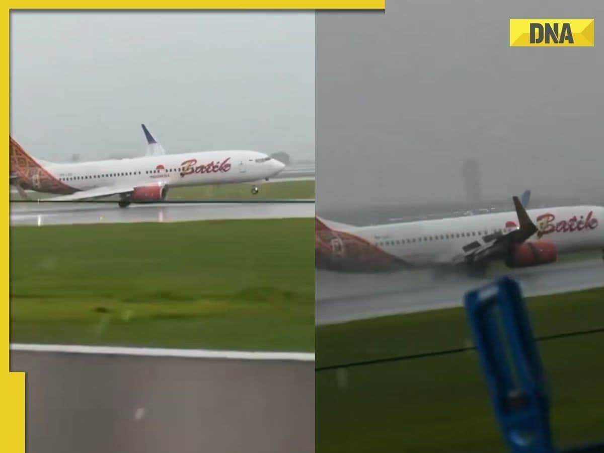
Batik Boeing 737 narrowly avoids wing strike in Heavy Thunderstorms and winds
2. Visibility: The reported visibility in METAR is the prevailing visibility as observed on the ground and may include the minimum visibility. Visibility is reported in metres. When Visibility is 10 km or more, it is denoted by 9999. Below 50 metres, it is denoted by 0000.
Directional Visibility in METARs: When visibility is not uniform in all directions, METARs may include directional variation codes. Here's how to interpret them:
a. Minimum visibility of 6000 meters in the south: Coded as 6000S → Visibility is 6000 meters towards the south.
b. Visibility less than 1500 meters in one direction, but more than 5000 in another: 1400SW 6000E → Visibility is 1400 meters to the southwest and 6000 meters to the east.
c. Limited visibility in one direction only: Example: 3000NW → Visibility is 3000 meters toward the northwest; no significant restrictions in other directions.
RVR (Runway Visual Range) indicates how far ahead a pilot can see down the runway from the touchdown point, in metres. (Threshold Visibility)
It’s reported in metres, usually in METARs when horizontal visibility is below 1500 m.
M means “less than” the value (e.g., R17/M0050 = RVR for Runway 17 is less than 50 meters)
P means “more than” the value (e.g., R09/P2000 = RVR for Runway 09 is more than 2000 meters).
U = RVR is trending upward (R09/0600U means the RVR on Runway 09 is 600 meters and improving)
D = RVR is trending downward (e.g., R28/0800D means 800 meters and dropping).
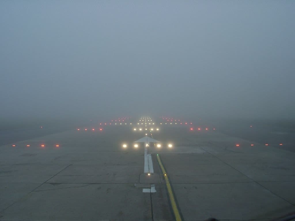
Low visibility conditions as seen from the Departure end of a runway; Source: Skybrary
3. Present weather: The weather group provides information about the current weather at or near the reporting aerodrome at the time of the observation.
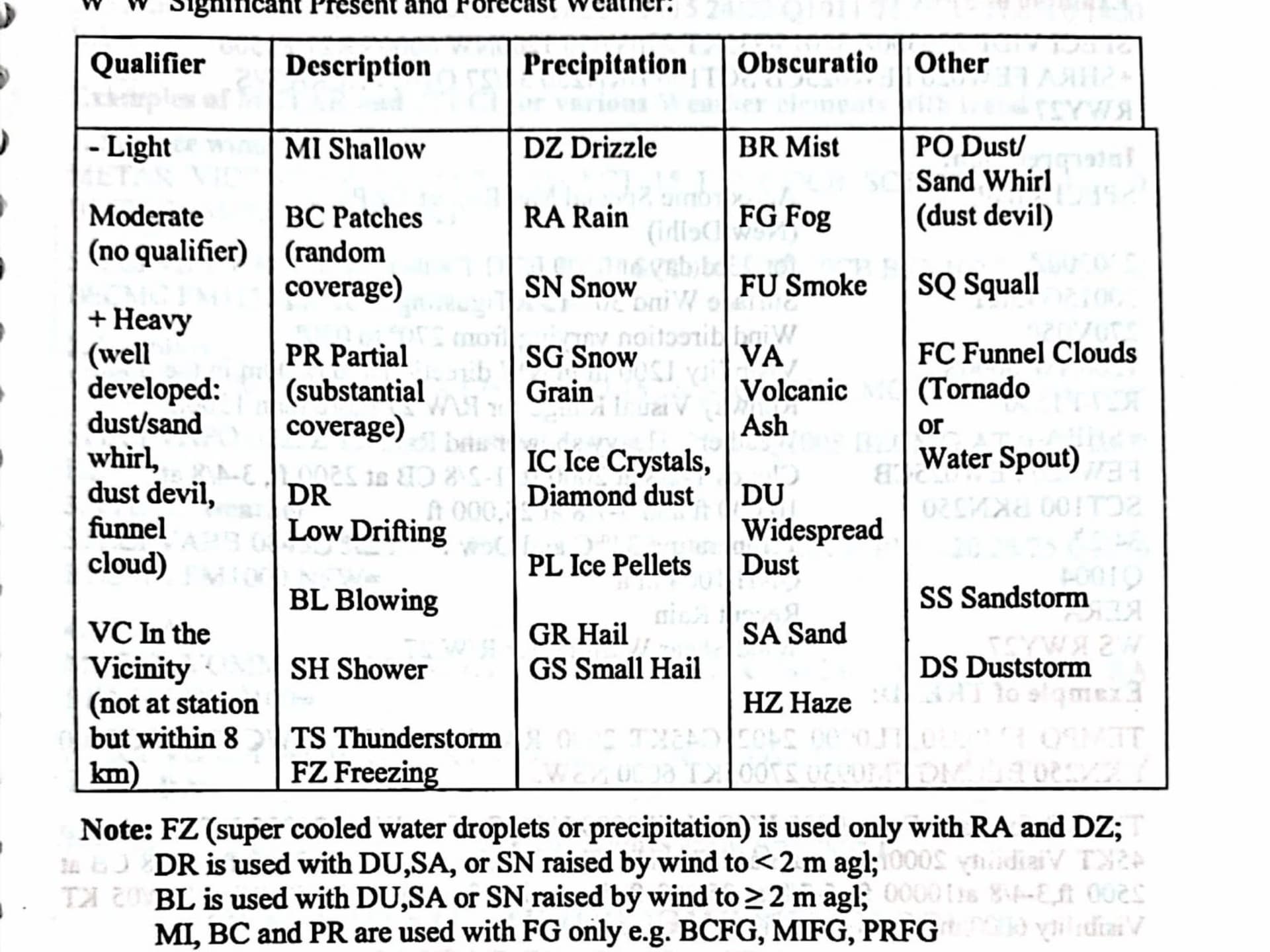
The table lists the different codes you'll come across in the weather section of a METAR, along with what each one actually means.
The first column shows the intensity or proximity of a weather phenomenon:
- – means light
- + means heavy
- VC means it's in the vicinity but not directly at the station (within 8 km)
- If there’s no symbol, the intensity is considered moderate.
The second column, labelled Descriptor, adds context to the phenomenon:
- BC = Patches (often fog)
- SH = Showers
- TS = Thunderstorm ( Reported if thunder has been heard within the last 10 minutes. If precipitation is present, two additional letters indicating its type are added after TS.)
The last three columns describe the actual weather:
- Precipitation includes codes for drizzle, rain, snow, hail, etc.
- Obscuration includes mist, fog, smoke and ash.
- The final column covers other phenomena not listed elsewhere.
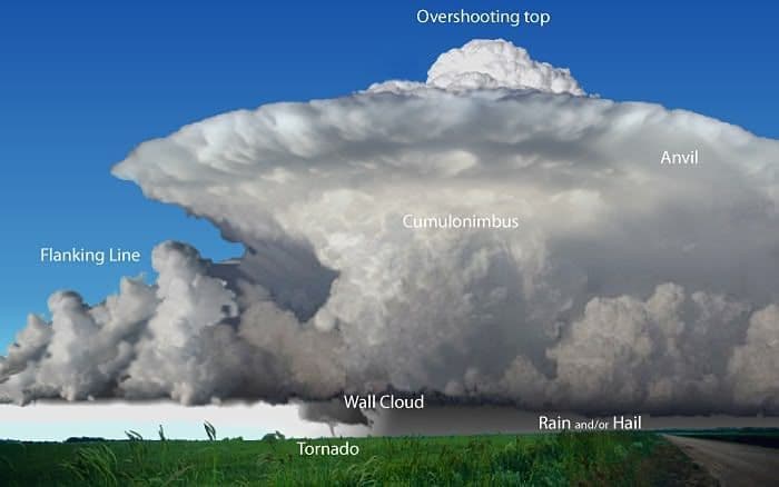
Supercell Thunderstorm; Source: NOAA
4. Cloud Cover: Cloud coverage in a METAR is described using specific three-letter codes that show how much of the sky is covered at a given level. The coverage is measured in oktas, where the sky is divided into eight equal parts:
- FEW: 1–2 oktas (a small amount of cloud)
- SCT (Scattered): 3–4 oktas (partly cloudy)
- BKN (Broken): 5–7 oktas (mostly cloudy)
- OVC (Overcast): 8 oktas (completely cloudy)
So, if 4 out of 8 parts of the sky are covered, the METAR would report it as SCT.
Cloud base is reported in steps of 30 metres up to 3000 m and 300 metres above 3000 metres. In a METAR, it is reported as a three-digit number representing hundreds of feet above the aerodrome, based on the current QFE setting.
For example:
- BKN019 means 6 oktas (broken cloud) at 1900 feet
- OVC005 means full overcast at 500 feet
Only significant convective clouds are specified by type in a METAR. These are cumulonimbus (CB) and towering cumulus (TCU).
If there’s no cloud of operational significance (CB or TCU), and no cloud at or below 5000 feet or the minimum sector altitude, the code NSC (No Significant Cloud) is used, unless CAVOK applies, which covers broader weather conditions.
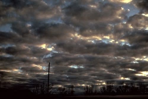
Broken cloud ceiling; Source: UBC EOAS
5.Obscuration : If the sky is obscured by something other than cloud, like fog, heavy snow, or dust and the actual cloud coverage can’t be observed, the code VV is used instead of the usual cloud information.
It’s followed by a three-digit number that shows vertical visibility in hundreds of feet. For example, VV002 means you can see up to 200 feet vertically.
Sometimes you'll see VV/// in a METAR, replacing the cloud height, when vertical visibility can’t be determined, usually due to dense obscuration like thick fog or heavy snow.
6. CAVOK: Another common code is CAVOK, short for “ceiling and visibility OK.” When CAVOK is used, it replaces the visibility, RVR, weather, and cloud groups in the METAR.
For CAVOK to appear, all four of these conditions must be met:
- Visibility is 10 km or more.
- No cloud below 5000 ft or below the highest minimum sector altitude, whichever is higher.
- No CB (cumulonimbus) or TCU (towering cumulus), i.e., Clouds of operational significance present.
- No significant weather at or near the aerodrome.
If all four apply, the METAR shows CAVOK, a shorthand for ideal flying conditions.

CAVOK condition; Credits: Thomas Paul
7. Temperature and Dew Point: The temperature and dew point in a METAR appear as two-digit numbers separated by a slash. First the temperature, then the dew point. Both are in degrees Celsius.
For example, 18/12 means the air temperature is +18°C and the dew point is +12°C.
If either value is negative, it’s marked with M (for "minus"). So 05/M04 means the dew point is –4°C.
Note: METAR uses standard mathematical rounding, i.e., rounding up to the next highest digit: +2.5 becomes 03, –2.5 becomes M02, –0.5 is M00

Dew forming on a leaf; Source: Britannica
8. QNH: It represents the atmospheric pressure at sea level, adjusted to the aerodrome. It’s shown with the letter Q followed by a four-digit number in hectopascals. If the pressure is below 1000 hPa, a leading zero is added.
For example, a QNH of 991 hPa would appear as Q0991.
The QNH is always rounded down for safety reasons if there are digits after the decimal point; for instance, if the QNH were 991.7 hectopascals, the QNH would be reported as Q0991.
In North America, QNH is reported in inches of mercury. It is indicated by the letter A, e.g. A2992 means 29.92 inches of mercury.
9. NOSIG: When no significant change is forecast during the reporting period, the code NOSIG (No Significant Change) is used.
10. Recent weather: If there was significant weather in the past hour that has since ceased or reduced in intensity, the code RE (for recent) appears in the METAR.
For example, if a thunderstorm occurred earlier but has now subsided, and only light rain is falling, the METAR will show RA as the current weather, and RETS to indicate a recent thunderstorm.
11. Windshear: Although not always included in METARs, windshear information is reported when necessary.
It appears with the code WS, followed by relevant details. For example:
WS ALL RWY means windshear reported on all runways.
If windshear is specific to a certain runway, it might appear as WS RWY27, indicating windshear on Runway 27.
SPECI
A variation of the METAR is the Special Weather Report, known as a SPECI. It follows the same format as a METAR, but with SPECI replacing METAR at the start of the report.
A SPECI is issued between routine METARs whenever there’s a significant change in weather conditions, whether that’s an improvement or a deterioration.
Criteria for Issuing a SPECI
A SPECI is issued when any of the following significant changes occur after the last METAR.
- For deterioration, the report is issued immediately.
- For improvement, it’s issued after 10 minutes of continued observation.
(a) Surface Wind
A SPECI will be triggered if:
Wind direction changes by 60° or more, and the wind speed before and after the change is ≥10 kt.
The mean wind speed changes by ≥10 kt.
Gusts vary by ≥10 kt from the mean, and the speed before and after the change is ≥15 kt.
(b) Visibility
Issued when visibility improves or deteriorates, crossing any of the following thresholds:
800 m, 1500 m, 3000 m, or 5000 m
(c) Runway Visual Range (RVR)
A SPECI is required when RVR changes or crosses:
150 m, 350 m, 600 m, or 800 m
(d) Present Weather
Issued on the onset, cessation, or intensity change of the following:
- Freezing precipitation or freezing fog (FZFG)
- Moderate or heavy precipitation
- Drifting or blowing snow, sand, or dust
- Dust storms (DS), thunderstorms (TS), squalls, or funnel clouds (tornadoes or waterspouts)
(e) Clouds
When the base of broken (BKN) or overcast (OVC) cloud layers is observed at:
30 m, 60 m, 150 m, 300 m, or 450 m
When cloud coverage below 450 m changes:
- From SKC/FEW/SCT to BKN/OVC
- Or from BKN/OVC to SKC/FEW/SCT
(f) Vertical Visibility
When the sky is obscured and vertical visibility changes or crosses:
30 m, 60 m, 150 m, or 300 m (i.e., 100, 200, 500, or 1000 ft)
Note: Applicable only when a laser ceilometer is installed.
(g) Surface Temperature
A SPECI is issued when the temperature increases by 2°C or more compared to the last report.
TREND Reports
The TREND forecast is a short-term landing forecast included at the end of a METAR or SPECI. It highlights expected significant changes in one or more of the weather elements over the next two hours.
Only the elements expected to change significantly are included. If no significant change is expected, the TREND section will say NOSIG (No Significant Change).
Important Points on TREND Forecasts
1. When Clouds Are Changing
If a significant change in cloud conditions (as per SPECI criteria) is expected, all cloud groups must be included in the TREND:
- Those expected to change
- And those expected to remain unchanged
2. Visibility Changes
Any phenomena causing reduced visibility must be mentioned.
TREND Codes and Their Meaning
- BECMG: Becoming – a gradual, lasting change. Includes a time range for when the change begins and ends.
- TEMPO: Temporary – short-term fluctuations, each lasting less than 1 hour, and together (all TEMPOs combined) less than half the forecast period. E.g. TEMPO FM1230 TL1430: Total forecast period is 0200 hours.
- These codes may be followed by:
- FM = from
- TL = until
- AT = at (a specific time)
Example
TEMPO FM1020 TL1220 1000 +SHRA
This means that between 1020 UTC and 1220 UTC, expect temporary heavy rain showers reducing visibility to 1000 meters.
AUTO in METARs
The code AUTO appears in METARs issued from fully or partially automated weather stations, usually at aerodromes with limited or no staff. These stations automatically generate weather reports at scheduled intervals without human input.
End of METAR: End of Message Sign
A METAR report ends with an "=" sign, which marks the end of the message.
If the departure/destination aerodrome doesn’t issue a METAR, pilots may consult the METAR from another one in the vicinity.
Whether you’re a student decoding your first METAR or a line pilot scanning a dispatch release, the goal is the same, turn data into decisions. Weather reports are early warnings, performance clues, and sometimes, life-saving red flags. Learn to read them with intent, not habit. Because in aviation, the ones who truly see the weather are the ones who stay ahead of it.
Got a METAR, TAF, or SIGMET you want decoded? DM us @6pistonsmedia on Instagram, X and LinkedIn and we’ll break it down for you.
All photos posted are properties of Tushar Gupta and may not be reposted or recirculated.
Continue Reading

Microbursts: The Invisible Threat You Must Never Underestimate
Microbursts are violent downdrafts that have brought down airliners and stunned pilots. Discover how they form, why they're deadly, and how you can spot and survive them.

The One Hour That Could Save Your Life: Understanding Dangerous Approaches
Most aviation accidents happen on approach, often because the warning signs are missed. This piece breaks down the key red flags: unstable profiles, rushed descents, visual illusions, and mental traps. With real-world context like Paro Airport and a simple decision-making framework, it’s essential reading for any pilot flying into challenging airfields